Back to Top
OriginLab Corporation - Data Analysis and Graphing Software - 2D graphs, 3D graphs, Contour Plots, Statistical Charts, Data Exploration, Statistics, Curve Fitting, Signal Processing, and Peak Analysis      
Buy Now Try Demo
Skip Navigation Links.

Surface with Transparent Plane


Show more of same type...            Show more using same keywords...

Download this project to learn how to make the graph.

Description:

This is a 3D colormap surface graph with a transparent plane that is created from topology data of Lake Ontario.

The graph layer contains two matrix data sets. The first layer shows the elevation of the land surrounding the shoreline, and the second shows the water level.


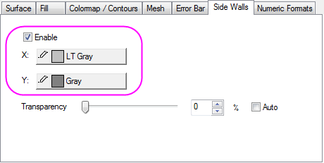
Add the Side Wall to the mountain surface plot in the Plot Details dialog.


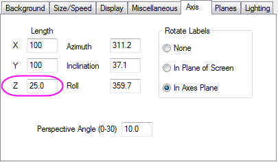
Set the Z-axis to show 25% of its full length in the Plot Details dialog.

© OriginLab Corporation. All rights reserved.
× _ Let's Chat